THE SUNSET TRAIL
MACE POINT SAVARY SHORES THE SOUTH SIDE MID-ISLAND Interior SAVARY ISLAND ROAD MEADOWS SUNSET TRAIL
THE SUNSET TRAIL
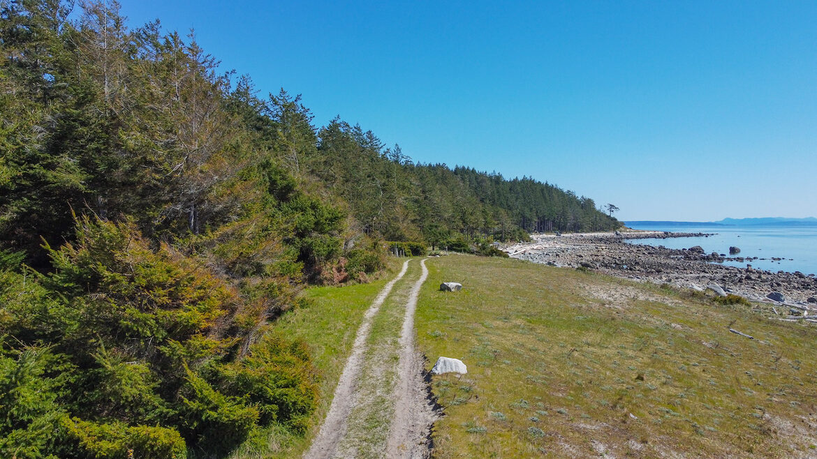
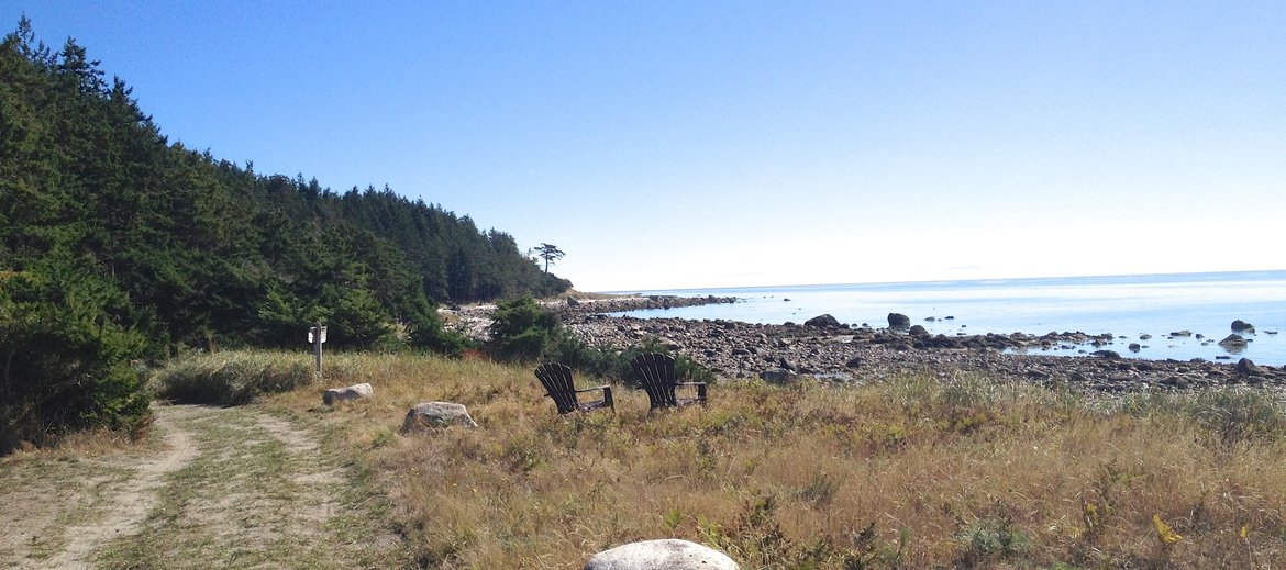
Originally the footpath from INDIAN POINT to THE MEADOWS, THE SUNSET TRAIL is now a stable community of residents & Summer residents who have been coming for decades.
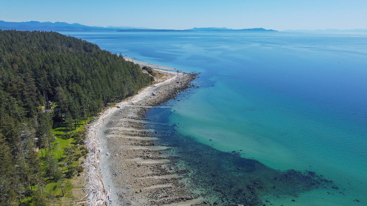
It is the only South facing beach front that is developed on Savary. There is some sandy, and a lot of rocky beach.
There is a sand bar that projects from the meadow end, that is quite wonderful in The Summer.
"Sunset to Midnight"
Visible to The West between Savary & Campbell River is Mittlenatch Island, A Provincial Park. I had believed that Mittlenach was a corruption of the German 'Mittel Nacht' ( Midnight ), However The Stewardship team claim it is of First Nations origin, with varying meaningsn Sliammon, Coast Salish & Kwakiutl. "CLINK"

Currently We have 3 Listings in this Area.
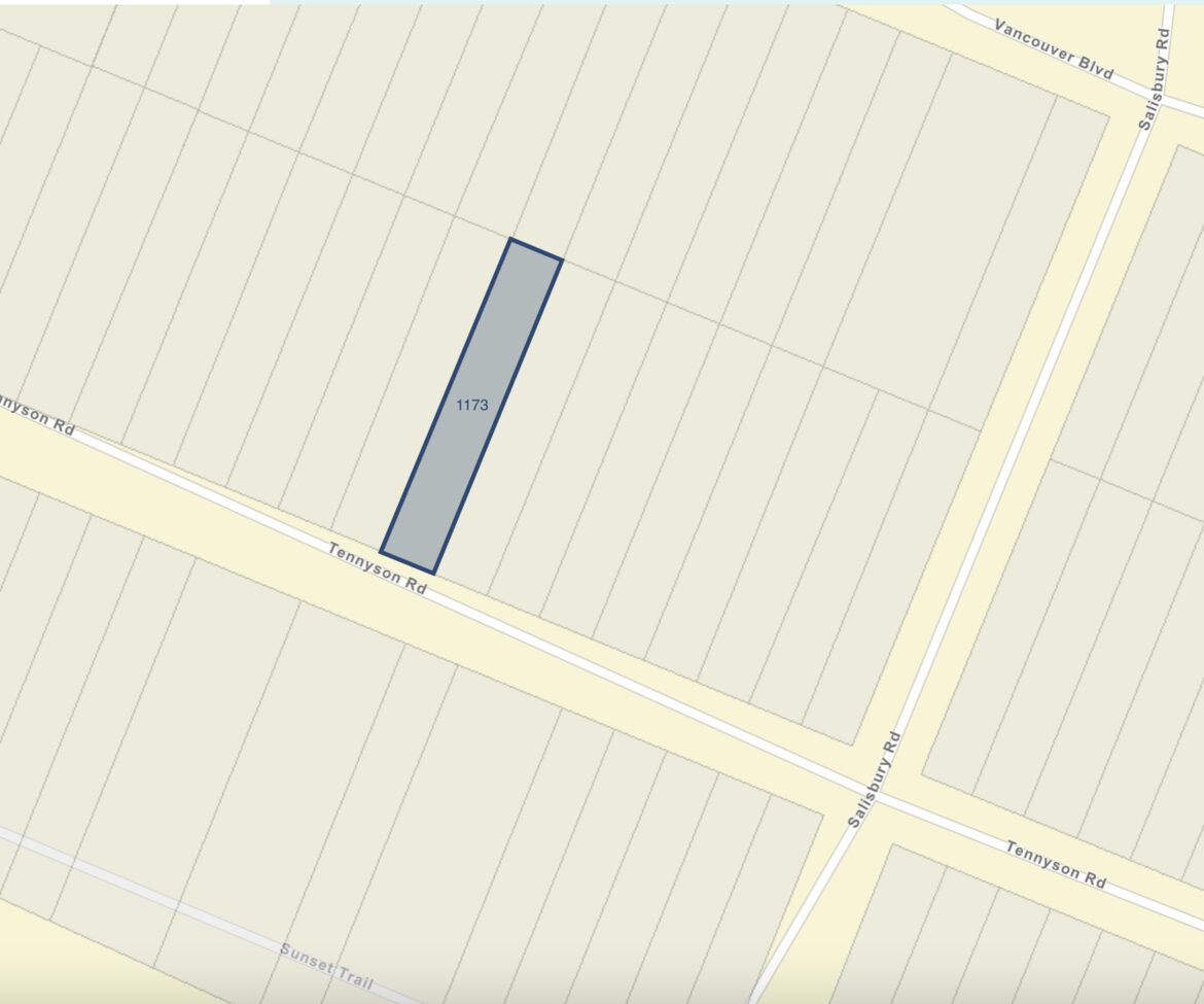
2 Waterfront Homes,11O1 SUNSET TRAIL $ 850,000 & 1141 SUNSET TRAIL $ 990,000 and an inside lot 1173 TENNYSON - $ 150,000
________________________________________________________________________
$ 990,000
like new, beach front home.
Walk-on-waterfront property with beautiful house available on Savary Island. This gorgeous 3 bdr , 2 bth , 2 level home is only 4 yrs old; virtually a brand new build on a walk-on-waterfront lot. Located on Sunset Trail this is one of the quietest spots on Savary Island. In addition to your own beach out front you are also located close to the Meadows Beach as well as the beaches of Indian Point. The impeccable build features beautiful exposed post and beam construction with lots of windows to take in the ocean view. This property can be enjoyed year round so you can enjoy all the seasons on Savary. Savary Island is one of the most beautiful islands off the coast of BC. With miles of sandy beaches, warm summer waters, and plenty of sun, it has been called the "Hawaii of the North." Watch Humpback Whales and Bald Eagles from the comfort of the spacious deck. Drilled Well, Septic, and Solar System round out this spectacular package. Live Cyber-tours are available upon request. Cell: 604-223-1494 Email: todd@savary.ca
_______________________________________________________________________________________________________________________________________
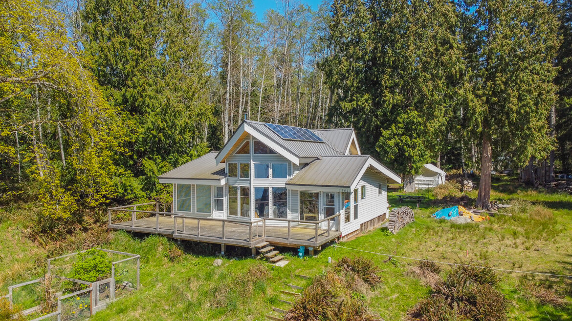
1101 SUNSET TRAIL $ 850,000
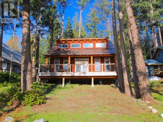
4 BEDROOM WATERFRONT HOME- "Dream Getaway".
__________________________________________________________________________________
Comfortable, contemporary, family cottage. Westward facing, no vehicle traffic in front. ( Drive in Access from Rodgers Road).
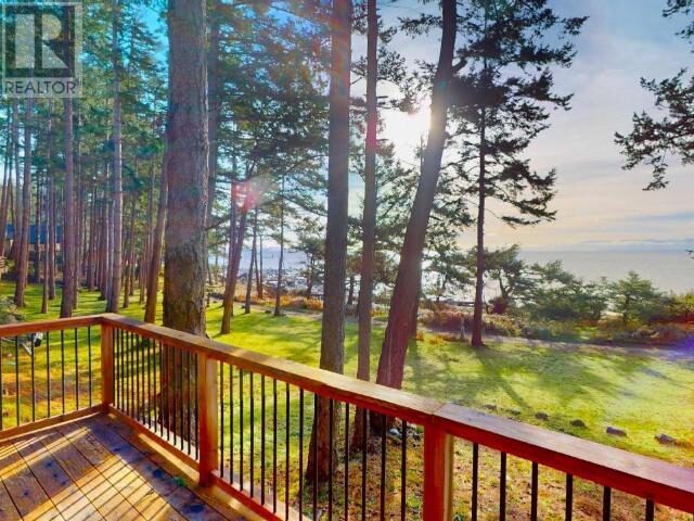
View to West, Mittelnatch Island, Vancouver Island. Road Allowance & Acreage to The North.
Experience the charm of rustic living with contemporary comforts in this low bank, west facing cottage
c on the most-western tip of Savary Island. This timber-frame constructed getaway, nestled 28 km from the mainland into Georgia Strait, offerS, 1364 sq ft of floor area with both rustic and contemporary architectural features.
The two storey features 3 main floor bedrooms, a 275 sq ft upper bedroom, and 1 & 1/2 lower floor bathroom combined with laundry.
The newly-renovated galley style kitchen boasts granite counter tops, a propane oven / stove
, and an electric refrigerator & a chest freezer..
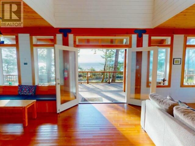
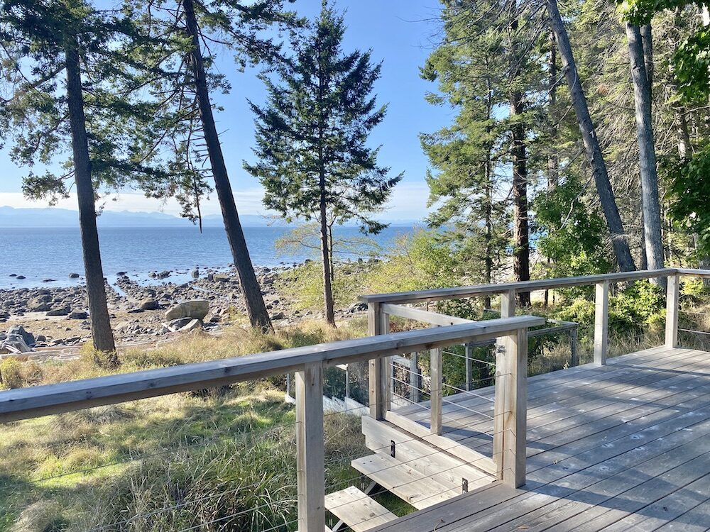
Stay warm with the wood burning enclosed fireplace heating system, and enjoy the outdoors on the new 525 sq ft cedar front deck, two 140 sq ft upper & lower rear deck.
The cottage is well-insulated with 1/2" drywall with vapour barrier & R12, 14.5 batt wall insulation throughout, Blue styrofoam rigid roof & floor insulation & double pane glazing.
The property is equipped with 6 roof mounted solar panels (2,400 watt-hr)
, new (2021) industrial-capacity deep- cycle storage batteries (12 x 2 Volt 1325 Ah), a controller inverter supplying 120 V AC power, a Honda 3000 AC/DC BACK UP GENERATOR , a shallow-well water supply with a 3-m3 above-ground reservoir, and an onsite septic wastewater ground dispersal system.
The location is absolutely spectacular. With Low Bank Waterfront (just 75 feet to the beach for a quick kayak or paddleboard launch), you can enjoy spectacular sunsets, watch and listen to whales, seals, sea lions, otters, mink, and eagles, and see the moon set and the stars come out - unobstructed by light pollution. Harvest crabs, oysters, clams, and mussels, go fishing off the reef for salmon, or watch the divers tend to the geoduck farm just offshore.
The property is extremely quiet and private, surrounded by an undeveloped road easement and acreage properties to the north, protected wetlands to the east, and low-occupancy cottages to the south. Enjoy direct access to Sunset Trail and a short walk to Indian Point which has a launch ramp for your trailered boat or zodiac. The cottage is located at the end of a self-maintained semi-private vehicle road access with no traffic or dust to contend with!
Don’t miss this opportunity to own a piece of paradise.
Contact us today for more information or to schedule a viewing on island. ---
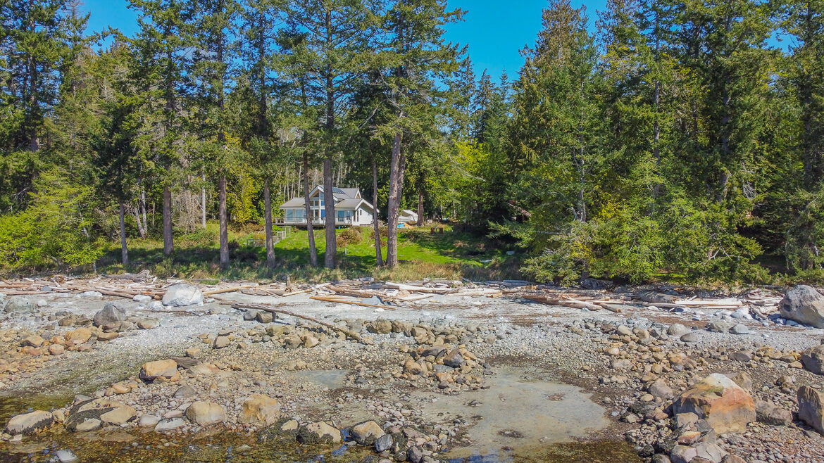
FROM THE BEACH
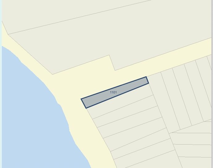
LOT DIMENSIONS- SUNSET TRAIL - 43 FT / RODGERS ROAD 282 FT / BACK 29 FT / INSIDE 276 FT
_________________________________________________________________________________________________________
FRONT DECK
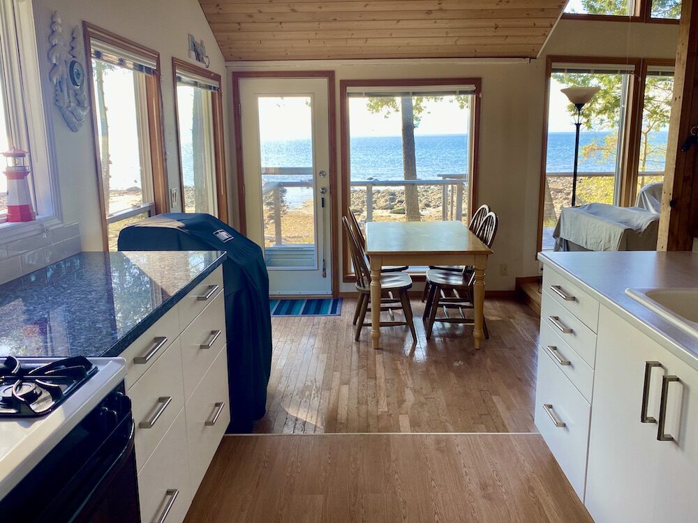
GALLEY KITCHEN
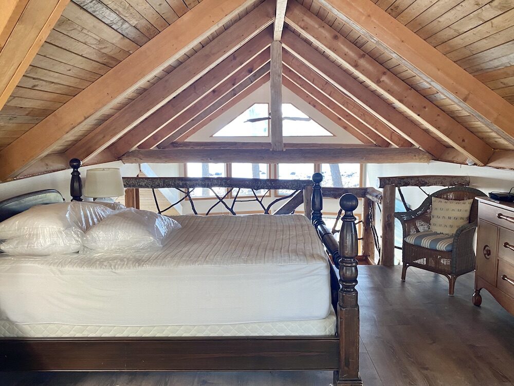
UPPER BEDROOM
__________________________________________________________________________________________________________________________________________________
1173 TENNYSON ROAD -
Undeveloped lot 50 x 300ft, one block back from Sunset Trail Beach, close to Meadow Beach too.
Vacant lot close to Sunset Trail on Savary Island. This 50 X 300 inland lot is located a short distance to Sunset Trail and the Meadows Beach. Situated between Salisbury Road and Herchmer Road this property is perfectly situated to take advantage of everything Mid-Island has to offer. Indian Point, Sutherland Beach, Mermaid Beach, Sunset Trail and the Meadows are all in the neighbourhood. This gently sloping, nicely treed lot is the ideal blank slate to build your island getaway. Call/text 604-223-1494 or email todd@savary.ca for a live cyber-tour.
$ 150,000